
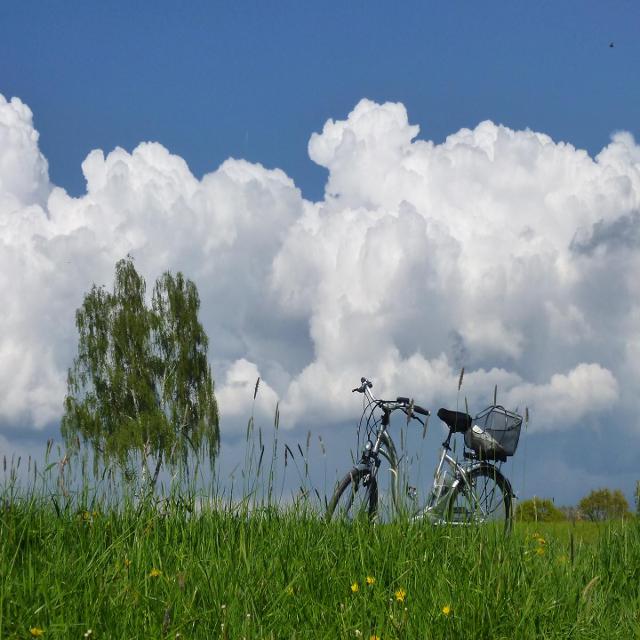
Rund um den Hirschenstein
6:15 h 588 hm 588 hm 18,6 km schwer
Sankt Englmar, Deutschland


Rund um den Hirschenstein mit tollen Panoramablicken, herrlicher Natur, guten Einkehrmöglichkeiten
-
Aufstieg: 588 hm
-
Abstieg: 588 hm
-
Länge der Tour: 18,6 km
-
Höchster Punkt: 1086 m
-
Differenz: 420 hm
-
Niedrigster Punkt: 666 m
Schwierigkeit
schwer
Panoramablick
sehr viele
Saisonale Eignung
-
JAN
-
FEB
-
MRZ
-
APR
-
MAI
-
JUN
-
JUL
-
AUG
-
SEP
-
OKT
-
NOV
-
DEZ
Merkmale Touren
Rundweg
Kultur
Kulinarisch
Einkehrmöglichkeit
Offen


Essen in der Nähe
"Essen in der Nähe" überspringen
ca. 1,3 km entfernt
Edelweiss-Appartements + Café
Kapellenweg 2, 94379 Sankt Englmar, Deutschland
Verbringen Sie unvergessliche Tage in unbeschreiblich schöner Natur.
Unterkünfte in der Nähe
"Unterkünfte in der Nähe" überspringen
ca. 0,1 km entfernt
Blockhaus 10 Zipflwiese
Hirschensteinweg 3, 94379 Sankt Englmar, Deutschland
Uriges Blockhaus an der Zipflwiese, am Fuße des Predigtstuhls, nur 200m bis zur Skipiste. WLAN, SAUNA, KAMIN

ca. 0,1 km entfernt
Ferienappartements Alkov
Am Predigtstuhl 4, 94379 Sankt Englmar, Deutschland
Unsere Ferienappartements Alois und Georg befinden sich im Bergdorf Sankt Englmar

ca. 0,1 km entfernt
Ferienwohnung Mia
Am Predigtstuhl 4, 94379 Sankt Englmar, Deutschland
Moderne Ferienwohnung in zentraler Lage.

ca. 0,1 km entfernt
Bayerwald Fewo Brinckmann
Am Predigtstuhl 4, 94379 Sankt Englmar, Deutschland
Schöne persönlich geführte Fewos

ca. 0,2 km entfernt
Appartement Honey
Am Predigtstuhl 2, 94379 Sankt Englmar, Deutschland
Inmitten des wunderbaren Bayerischen Waldes, hoch über dem Ort Sankt Englmar auf 900 m gelegen, begrüßen wir Sie in unserem renovierten Appartement.

ca. 0,2 km entfernt
Appartement Sternblick
Am Predigtstuhl 2, 94379 Sankt Englmar, Deutschland
Familiär geführtes Appartement im Stil der 70er Jahre renoviert.

ca. 0,2 km entfernt
Bergerlebnis Natur pur
Am Predigtstuhl 2, 94379 Sankt Englmar, Deutschland
Bei dieser besonderen Unterkunft sind alle wichtigen Anlaufpunkte ganz in der Nähe – so wird die Planung Ihres Aufenthalts ganz einfach.

ca. 0,2 km entfernt
Ferienwohnung Marion
Am Predigtstuhl 2, 94379 Sankt Englmar, Deutschland
Zwei hübsche Ferienwohnungen (33 und 53 qm) für bis zu 6 Personen. Ideal für Familien, Wanderer und Skifahrer.

ca. 0,2 km entfernt
Graf´s Appartement Sankt Englmar
Am Predigtstuhl 2, 94379 Sankt Englmar, Deutschland
Private Vermietung einer neu renovierten, gemütlichen Ferienwohnung mit großer Badelandschaft, Sauna, Fitnessraum im Predigtstuhlresort.

ca. 0,2 km entfernt
Waldwipfel-Appartements
Am Predigtstuhl 2, 94379 Sankt Englmar, Deutschland
Neu renoviertes, stilvoll eingerichtetes Design-Appartement mit 2 Zimmern (4 Betten) in ruhiger Lage mit sonnigem Balkon im Predigtstuhl-Resort.


ca. 0,2 km entfernt
Apartment Abendsonne
Am Predigtstuhl 2, 94379 Sankt Englmar, Deutschland
Top Apartment mit Weitblick und Late Check-Out im Predigtstuhl Resort.

ca. 0,2 km entfernt
Ferienvermietung Hecht
Am Predigtstuhl 2, 94379 Sankt Englmar, Deutschland
Gemütliche, stilvolle Fewo mit 2 Zimmern mit sonnigem Balkon im Predigtstuhlresort.

ca. 0,2 km entfernt
Ferienwohnung Bergzeit
Am Predigtstuhl 2, 94379 Sankt Englmar, Deutschland
Frisch renovierte Ferienwohnung Bergzeit im Predigtstuhl Resort in Sankt Englmar.

ca. 0,2 km entfernt
Ferienwohnung Berti
Am Predigtstuhl 2, 94379 Sankt Englmar, Deutschland
Unsere schön gelegene Familienferienwohnung hat 53 qm in Maisonettebauweise und bietet Platz für 2 Erwachsene und 3 Kinder.

ca. 0,2 km entfernt
Ferienwohnung Hüttenzauber
Am Predigtstuhl 2, 94379 Sankt Englmar, Deutschland
Gemütliche, renovierte Ferienwohnung mit großem Balkon

ca. 0,2 km entfernt
Ferienwohnung Kleine Auszeit
Am Predigtstuhl 2, 94379 Sankt Englmar, Deutschland
Unsere Ferienwohnung Kleine Auszeit bietet Ihnen auf insgesamt 53 m² genügend Platz für bis zu 5 Personen.

ca. 0,2 km entfernt
Ferienwohnung Tanja
Am Predigtstuhl 2, 94379 Sankt Englmar, Deutschland
Gelegen in Sankt Englmar im Bayrischen Wald, inmitten von Ski - und Rodelpisten, Wanderwegen , Tier- und Freizeitparks.

ca. 0,2 km entfernt
Ferienwohnung Wallner Rosi
Am Predigtstuhl 2, 94379 Sankt Englmar, Deutschland
Inmitten des wunderbaren Bayerischen Waldes, hoch über dem Luftkurort St Englmar, auf 900 m gelegen, begrüßen wir Sie in unserem gemütlichen Appartement.

ca. 0,2 km entfernt
Ferienwohnung Winklworld 2
Am Predigtstuhl 2, 94379 Sankt Englmar, Deutschland
Die neu renovierte Ferienwohnung Winklworld 2 mit kostenloser aktivCARD erwartet euch im Luftkurort Sankt Englmar in bester Ausgangslage mit Hallenbad, Außenpool, Sauna, Fitnessraum, Minigolf, Tischtennis und kostenfreien Privatparkplätzen.
Weitere Tipps in der Nähe
"Weitere Tipps in der Nähe" überspringen
ca. 0,0 km entfernt
Tour zum Waldwipfelweg
Sankt Englmar, Deutschland
Tour zu den wichtigsten Freizeiteinrichtungen in Sankt Englmar
3:40 h 490 hm 488 hm 14,8 km leicht

ca. 0,0 km entfernt
Naturlehrpfad Wildes Waldgebirge
Sankt Englmar, Deutschland
Der Naturlehrpfad Wildes Waldgebirge führt sie über die 3 Tausender Predigtstuhl, Hochberg und Knogl. Eine abwechslungs- und lehrreiche Wanderung erwartet Sie!
2:30 h 176 hm 176 hm 5,2 km mittel

ca. 0,0 km entfernt
Naturlehrpfad Wildes Waldgebirge
Rathausstraße 6, 94379 Sankt Englmar, Deutschland
Erleben Sie das "Wilde Waldgebirge" in Sankt Englmar

ca. 0,0 km entfernt
Hirschenstein über Höhenried und Ödwies
Sankt Englmar, Deutschland
Der Hirschenstein ist mit 1095m der interessanteste Aussichtsberg im Bayer. Wald. Er ist von allen Seiten zu besteigen-von Höhenried ist die längste und abwechslungsreichste Route
5:00 h 195 hm 349 hm 16,0 km schwer

ca. 0,1 km entfernt
Rodeln 300-m-Hang
OT Predigtstuhl, 94379 Sankt Englmar, Deutschland
Nähe Tannenhof - am Start zur Hirschensteinloipe

ca. 0,1 km entfernt
Knogl Loipe
Sankt Englmar, Deutschland
DSV nordic aktiv Langlaufzentrum St. Englmar-Hirschentein
1:00 h 137 hm 208 hm 8,4 km mittel
Langlaufen-Tour ( Klassisch / Skating )

ca. 0,1 km entfernt
E-Biketour mit Bikeguide
Hirschensteinweg, 94379 Sankt Englmar, Deutschland
Do., 01.08.2024 und weitere

ca. 0,1 km entfernt
Mountainbiketour "Gipfeltour"
Hirschensteinweg, 94379 Sankt Englmar, Deutschland
Jeden Donnerstag, Geführte Mountainbiketour "Gipfeltour"
Di., 30.07.2024 und weitere
Veranstaltung Sportveranstaltung Führung/Sightseeing Ausflug

ca. 0,1 km entfernt
ca. 0,1 km entfernt
Winterrodelhang am Predigtstuhl
Sankt Englmar, Deutschland
Seitlich der Loipe Predigtstuhl-Hirschenstein verläuft der 300m lange Rodelhang. Bitte betreten Sie nicht die LOIPE!
0:00 h 26 hm 26 hm 0,3 km sehr leicht

ca. 0,1 km entfernt
Hochwaldloipe
Sankt Englmar, Deutschland
Hochwaldloipe - DSV nordic aktiv Langlaufzentrum St. Englmar-HirschensteinLänge 3,5 km; leichte Loipe; nur klassische Spur
0:40 h 99 hm 93 hm 3,5 km sehr leicht
Langlaufen-Tour ( Klassisch )

ca. 0,1 km entfernt
Hirschensteinloipe
Sankt Englmar, Deutschland
Hirschensteinloipe - DSV nordic aktiv Langlaufzentrum St. Englmar-HirschensteinLänge 14,9 km; Schwierigkeitsgrad mittel bis schwer; Kombi-Loipe
3:44 h 392 hm 374 hm 14,9 km mittel
Langlaufen-Tour ( Klassisch / Skating )

ca. 0,1 km entfernt
Englmarer Hüttenwanderung – ein Goldsteig-Ge(h)nuss in 4 Gängen
Am Predigtstuhl 1, 94379 Sankt Englmar, Deutschland
Fr., 02.08.2024 und weitere
ca. 0,1 km entfernt


ca. 0,1 km entfernt
Englmarer Hüttenwanderung
Sankt Englmar, Deutschland
Eine kulinarische Wanderung rund um den Sankt Englmarer Hausberg Pröller erleben: Die perfekte Verbindung von Natur – Kulinarik und Sport.
2:30 h 244 hm 227 hm 8,6 km leicht

ca. 0,2 km entfernt
e-Bike Verleih Bergsport Predigtstuhl
Am Predigtstuhl 1, 94379 Sankt Englmar, Deutschland
Der E-Bike Verleih in Sankt Englmar im Bayerischen Wald

ca. 0,2 km entfernt
Skischule Bergshop24 - Sankt Englmar
Am Predigtstuhl 1, 94379 Sankt Englmar, Deutschland
Skischule am Predigtstuhl

ca. 0,2 km entfernt
4D Arena St. Englmar
Am Predigtstuhl 7, 94379 Sankt Englmar, Deutschland
Auf 1460 qm direkt neben dem Kletterwald St. Englmar befindet sich die 4D Eventarena mit folgenden Angeboten.
Das könnte Dir auch gefallen
"Das könnte Dir auch gefallen" überspringen
Rundwanderweg Elisabethszell-Haibach -rote1-
Haibach, Deutschland
Dieser Rundwanderweg verbindet die zwei Hauptorte in der Gemeinde - Haibach und Elisabethszell.
3:00 h 410 hm 410 hm 10,7 km sehr leicht

Steinreiche Tour zur Käsplatte
Sankt Englmar, Deutschland
Eine Tour, die mit tollen Panoramablicken und bizarren Felsformationen besticht
3:55 h 351 hm 339 hm 11,8 km mittel

Zuweg Goldsteig - Nr. 27D Elisabethszell - Maibrunn
Neukirchen, Deutschland
Wandern zwischen Haibach, Elisabethszell und St. Englmar.
1:30 h 230 hm 18 hm 3,5 km mittel

Rundwanderweg Nr. 3a - Scheibelsgruber Strecke (Unteres Perlbachtal)
Mitterfels, Deutschland
Wer auf dem Rundweg 3 den imposanten Teufelsfelsen und die naturbelassene Menach sehen, aber nicht bis nach Weingarten gehen möchte, wählt die Variante 3a als Abkürzung.
1:00 h 124 hm 124 hm 3,8 km leicht

Elisabethszell - Hanslhütte
Haibach, Deutschland
Elisabethszell - Hanslhütte
1:00 h 240 hm 4 hm 2,0 km sehr leicht

Rundwanderweg Nr. 1 - Liebeshain-Pfad - (Oberes Perlbachtal)
Mitterfels, Deutschland
Der Weg führt durch das Obere Perlbachtal entlang der schönen Menach zum ehemaligen Waldbad (heutiger Zeltplatz). Zurück geht es über einen schmalen Steig, Liebeshain genannt.
1:30 h 147 hm 160 hm 2,8 km leicht

Rundwanderweg Nr. 2 - Buchberger Runde
Burgstraße 3, 94360 Mitterfels, Deutschland
Dieser Weg führt nicht nur zu einem original erhaltenem Waldlerhaus, sondern auch zum Kögl-Kreuz, dem höchsten Punkt von Mitterfels, einem Platz mit beeindruckender Aussicht.
1:30 h 283 hm 283 hm 5,3 km mittel

Rundwanderweg Nr. 3 - Weingarten-Weg - (Unteres Perlbachtal)
Mitterfels, Deutschland
Der Weg führt durch das Untere Perlbachtal vorbei am imposanten Teufelsfelsen entlang der Menach zum Obstlehrgarten nach Weingarten mit Rastmöglichkeit und schönem Ausblick.
3:00 h 230 hm 230 hm 7,2 km leicht